Introduction
Plane table is the graphical method of survey in which the field observation proceeds simultaneously. The surveying in which we use plane table instrument that surveying is known as plane table surveying.
Principle of plane table surveying
The principle of plane table surveying is based in the fact
that the line joining the point on the plane table are made to lie parallel to
their corresponding lines joining the ground points while working at each
station.
Accessories required for plane table surveying
- · Plane Table with Tripod Stand
- · Alidade
- · Spirit Level
- · Magnetic Compass
- · Plumb Bob and Plumb Fork
- · Drawing Paper
Plane Table with Tripod Stand
It consists of wooden table mounted on the light tripod in
such a way that the tabletop may be rotate about its vertical axis and can be
claim in any position. The tabletop is leveled by adjusting the leg of tripod.
The size of plane table is usually 450mm*600mm, 500mm*700mm
and 600mm*750mm.
Alidade

The plane table alidade is a instrument which is used to
sight object through object vane. There are two type of alidade which are
generally used:
v
Plane Alidade
v
Telescopic alidade
Plane Alidade
It generally consists of metal or wooden ruler with two
vanes at the end’s vanes are hinged and can be folded on the ruler when alidade
is not being used. One of the vanes is known as sight vane and other vane is
known as object vane.
Telescopic Alidade
The alidade which ais fitted with a telescope is known as
telescopic alidade. It is generally used when it is required to take inclined
side.
Spirit Level

It is consisting of small metal tube which contain a small
bubble. The spirit level may also be circular but its base most be flat so that
it can be laid on the table. The table is truly leveled when bubble remain
central all over the table.
Magnetic Compass
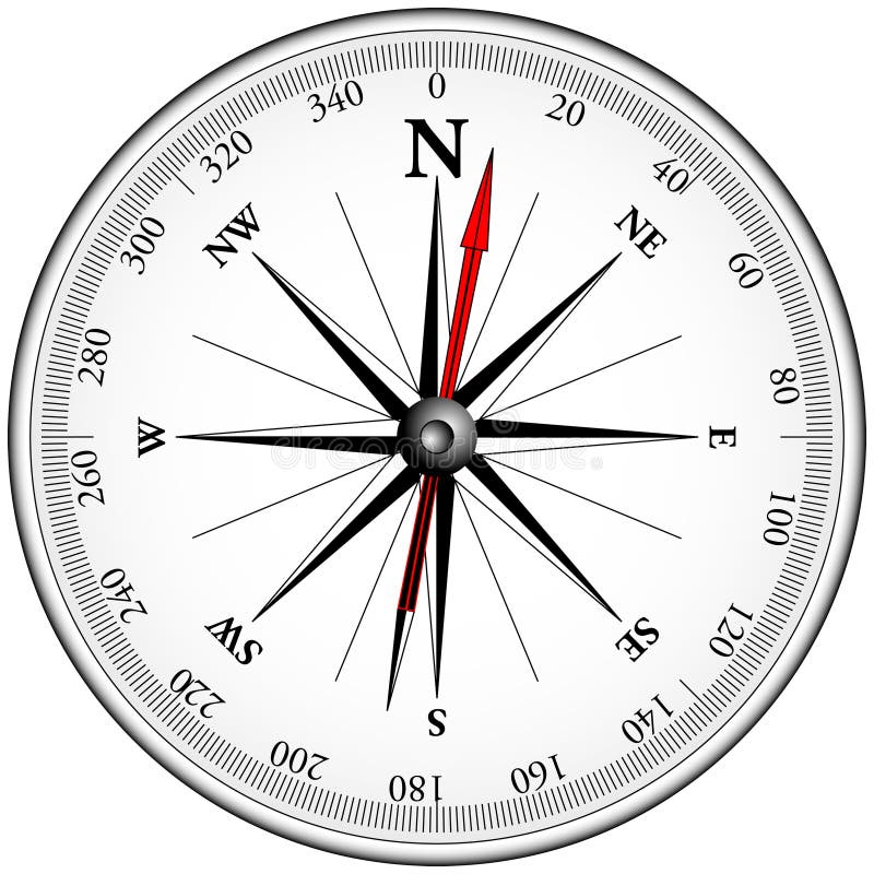
A box compass consists of a magnetic needle pivoted at its
center freely. It is used for orienting the plane table to the magnetic north.
The edge of the box compass is straight, and the bottom is perfectly flat.
Plumbing Bob and Plumbing Fork

The plumbing fork consists of hair pin shape brass frame
having two equal arms of equal length one end has pointer while a plumb bob is
attached to another end. It is used for transforming location of instrument
station on the ground.
Drawing Paper
The drawing paper used for plane tabling must be of superior
quality.
Working Operation of plane table
Following three operations are carried out at each station:
·
Fixing the plane table on tripod stand
·
Leveling up the plane table
·
Sighting the station point
Fixing the plane table in tripod stand
In this method strip of tripod is unfolded and the legs of
the tripod are well spread. The bolt is removed from the annular ring and the
table is place on the top of the tripod so, that it is lifted well with the
clamping assembly of the tripod.
Leveling up the plane table
The setting up operation consist of the following:
v
Leveling the plane table
v
Centering the plane table
v
Orienting the plane table
Leveling the plane table
In this operation the tabletop is made truly horizontal for
rough and small scale work, leveling can be done by eye estimation where as for
accurate and large scale work leveling is achieved with an ordinary spirit
level.
Centering the plane table
In this operation the location of the plane table station on
the paper is brought exactly vertical above the ground station position this
operation is known as centering of the plane table. Plumb bob and plumb fork
are used for centering the plane table.
Orienting the plane table
Orientation is the process of putting the plane table into
same fixed direction so that line representing a certain direction on the table
is parallel to the direction on the ground.
Sighting the station point
When once the level has been set that is leveling, centering,
and orienting has been done the points to be located are sighted through the
alidade. The alidade is kept pivoted about the plotted location of the
instrument station and is turned so that the line of sight bisects the sight at
the to be plotted.
Method of plane table surveying
There are four methods of surveying with plane table:
v
Radiation Method
v
Intersection Method
v
Traversing Method
v
Resection Method
Radiation Method
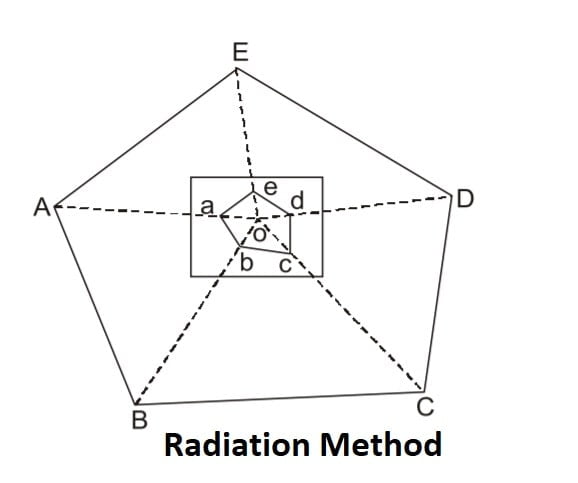
In this method the objects are located by radiating lines
from the point and measuring the distance with tape with suitable scale. It is
used for locating the details from the station which has been established
Previously by other method. This method is suitable for small area survey.
Intersection Method

In this method the point is fixed on the plane by the
intersection of the rays drawn from the two instruments stations. The lines
joining the station is called base line. This method require only linear
measurement of the line.
Errors in plane table surveying
ü
Instrumental Error
ü
Personal Error
ü
Plotting Error
Instrumental Error
The primary source of instrumental error in plane table
surveying arises from the lack of temporary adjustment, thus the cause of
instrumental errors are as follows:
1.Undulation of plane table
Errors in observation as well as plotting will occur if the
top surface of the plane table is not perfectly plain.
2.Lose fitting of plane table
If the fitting of plane table and that of tripod are loose,
the plane table will not remain stable and the error in surveying will occurs.
3.Improper Magnetic Compass
If the magnetic compass doesn’t represent proper magnetic
direction and error is originated in the plane table surveying.
4.Defect in spirit level
If the level tube is defected, the plane table will not be
horizontal when bubble is central.
5.Poor Quality of drawing sheet
Personal Error
1.Improper leveling of the plane table
If the plane table is not leveled properly and the main
horizontal sight vane will be inclined to the vertical. These would be an error
and the points located will not be correct.
2.Inaccurate centering
If the plane table is not accurately centered the error in
plotted position of the station will cause error in plotting in all other
details from the station.
3.Improper orientation
If the plane table is not oriented properly than, the
plotting in general will be inaccurate.
Plotting Error
This may cause due to any error in measurement of the
distance or direction of the ray due to error in the instrument or error
manipulated on sighting. This will lead to inaccurate map of the survey and
thus, the objective of the survey will not be properly achieved.
Advantage of plane table surveying
I.
It is most suitable for preparing small scale
map.
II.
It is most rapid.
III.
It is particularly advantageous in magnetic area
where compass survey is not reliable.
IV.
No grade skill is required to prepare a
satisfactory map.
V.
It is less costly than theodolite survey.
VI.
Field book is not required for plane table surveying.
Disadvantage of plane table surveying
I.
It is heavy and awkward to carry.
II.
It is not suitable for work in wet climate.
III.
It is not intended for accurate work.
IV.
It is not suitable for preparing large scale
map.